Soil Moisture Indices
Soil moisture plays an important role in the water, carbon and energy cycles. The amount of moisture in the soil is an important variable for understanding surface-atmosphere coupling. As an Essential Climate Variable (ECV), soil moisture is a key component in improving weather forecasting and climate models as well as improving precipitation estimates, monitoring droughts, and forecasting natural hazards such as landslides and floods. Thanks to a series of satellite sensors with different characteristics, it is possible to study soil moisture content and related water stress at different spatial scales, from a few tens of kilometres to hundreds or even tens of metres. Many methods exist to derive water stress indicators from remote sensing, but performances can vary greatly. Therefore, a well-informed decision on what data types and what algorithm(s) to use should be based on data availability and user needs and requirements.
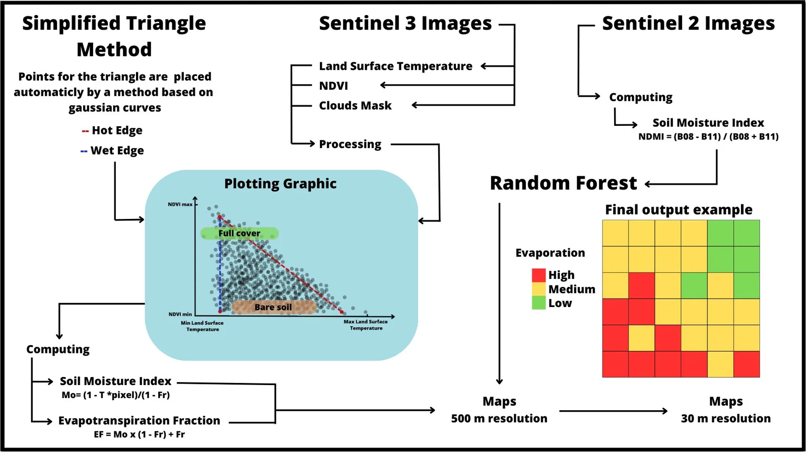
The WaSCIA service will primarily use Sentinel-3 data for water stress monitoring, given the suitability of its sensors and the correct temporal resolution. For calculating evaporative losses and soil wetness dynamics, the “Simplified Triangle” technique will be used (Petropoulos et al., 2020). In order to achieve a better spatial resolution, the application will fuse Sentinel-3 with Sentinel-2 based soil moisture index.
The Sentinel-3 derived indicators will be downscaled to 30 m resolution using the Random Forest (RF) model that demonstrates the relationship between the S-2 channels and the S-3 channels, which are at a lower spatial resolution but much higher temporal resolution. The RF model is then used to predict 10 m water stress indicators based on S-2. Such models have already successfully applied to downscale MODIS 1 km daily ET with Landsat 8 (Ke et al., 2016). The accuracy of this water stress product will be determined by comparing it with local, in situ measurements from our local project partners.
The goal of the WaSCIA service is to provide crucial information to help detect early onsets of water stress related to drought conditions, its severity and spatial extent all over Senegal. It will also improve the understanding of water-crop productivity in the long term and support efforts towards yield forecasting and food security.