Earth Observation
Satellite images are invaluable for monitoring water stress. They enable the assessment of vegetation health, land surface temperature, and water availability over large areas. By analyzing these images, the project team can give stakeholders the ability to identify regions experiencing water stress, plan resource management, and aid in drought mitigation strategies.
In this project, we process images from the Sentinel-3 and Sentinel-2 missions of the Copernicus program by ESA. Sentinel-3 monitors oceans, land, and atmosphere, while Sentinel-2 focuses on high-resolution imaging of land surfaces. Both provide valuable data for climate, ecosystem, and land monitoring applications, aiding in environmental understanding and management.
After retrieving water stress indicators from the Sentinel-3 satellite images, the team uses Sentinel-2 satellite images and Random Forest as a technique to enhance the spatial resolution of the coarser Sentinel-3 data. By training a Random Forest algorithm with high-resolution Sentinel-2 data and corresponding low-resolution Sentinel-3 data, it can predict fine-scale details in the Sentinel-3 imagery. This approach enables more detailed analysis and monitoring of water stress at a local level.
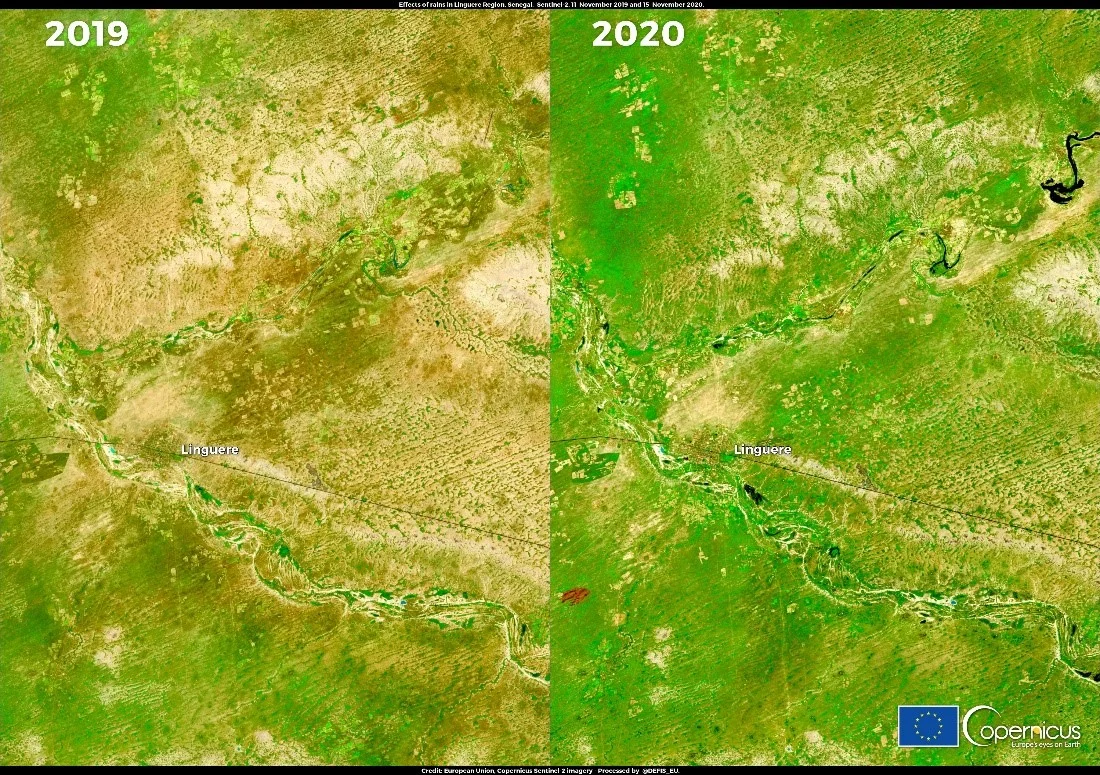
European Commission, Copernicus Sentinel-2 Mission – Comparison between a Sentinel-2A image taken on 11th November 2019 and a Sentinel-2B image taken on 15th November 2020 showing the effects of intense rainfall near the town of Linguere after 6 years of drought. https://www.copernicus.eu/et/node/10014