Climate Indices
Timely action to assess the climate risk and address the impact of extreme weather requires ready access to trustworthy environmental information, increasingly derived from EO satellites. Policy makers and research groups at national and international level are fuelling the emerging demand for EO data as the importance of the assessment of climate risk becomes more evident. For the EO and climate services to be unequivocally relied upon requires data and information to be available geographically and temporally on demand.
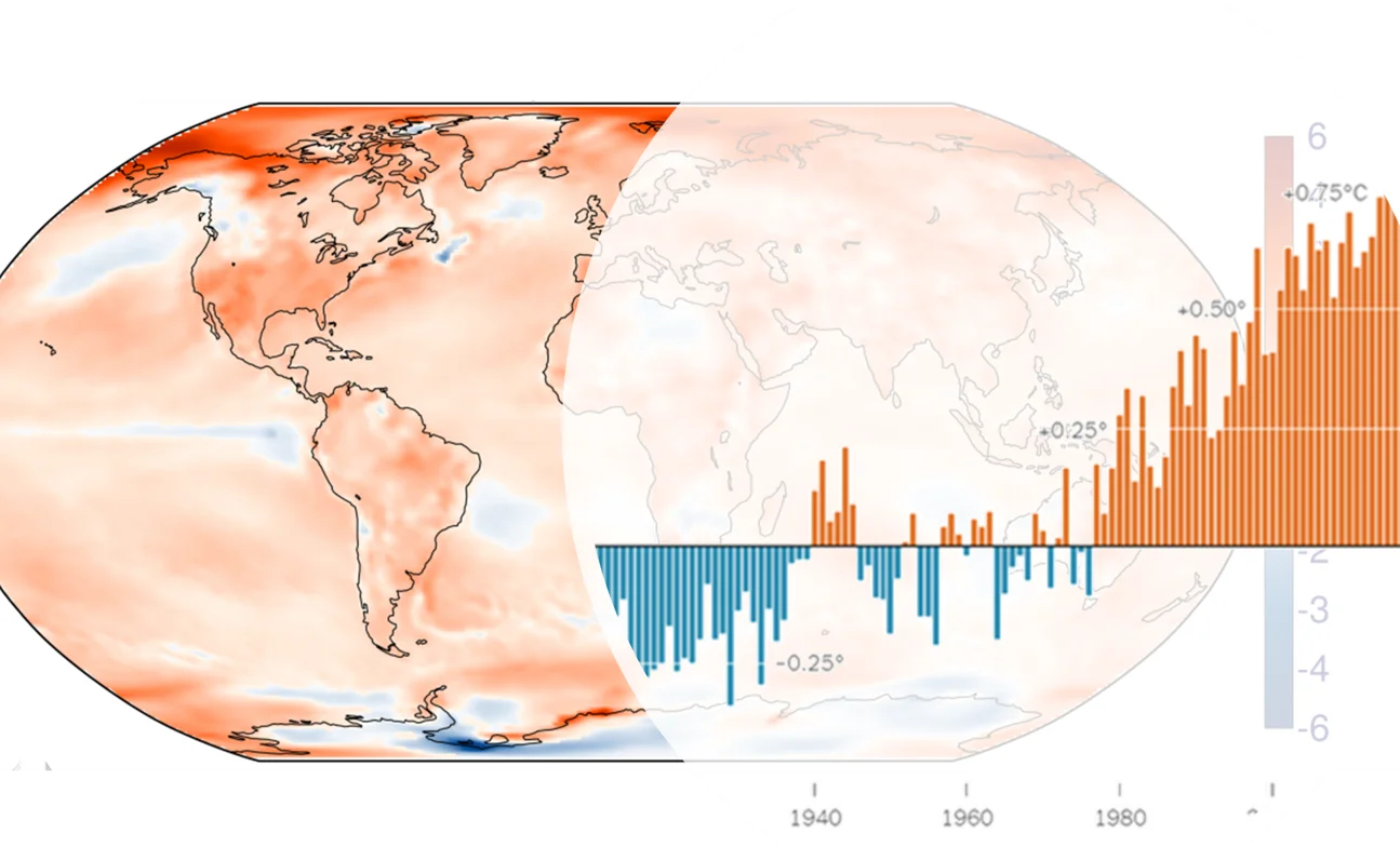
Climate indices are standardised metrics for assessing climate variability based on various meteorological variables, often using daily meteorological data. They are useful in conveying long-term climate variability and characterising the climate anomalies. Some climate indices are used to detect extremes in temperature and precipitation, such as the 27 core indices developed by the Expert Team on Climate Change Detection and Indices (ETCCDI).
WaSCIA will provide a set of Climate indices through a highly flexible and interactive interface, enabling end-users to quickly assess the climate condition in their region of interest and analyse both the long-term trends in climate variability and the current season anomalies up to 5 days behind real time. The end-users will also be able to take advantage of the advanced interfaces to interrogate the data and produce customised metrics useful for their operations.